WHAT’S IN A NAME?
2018-
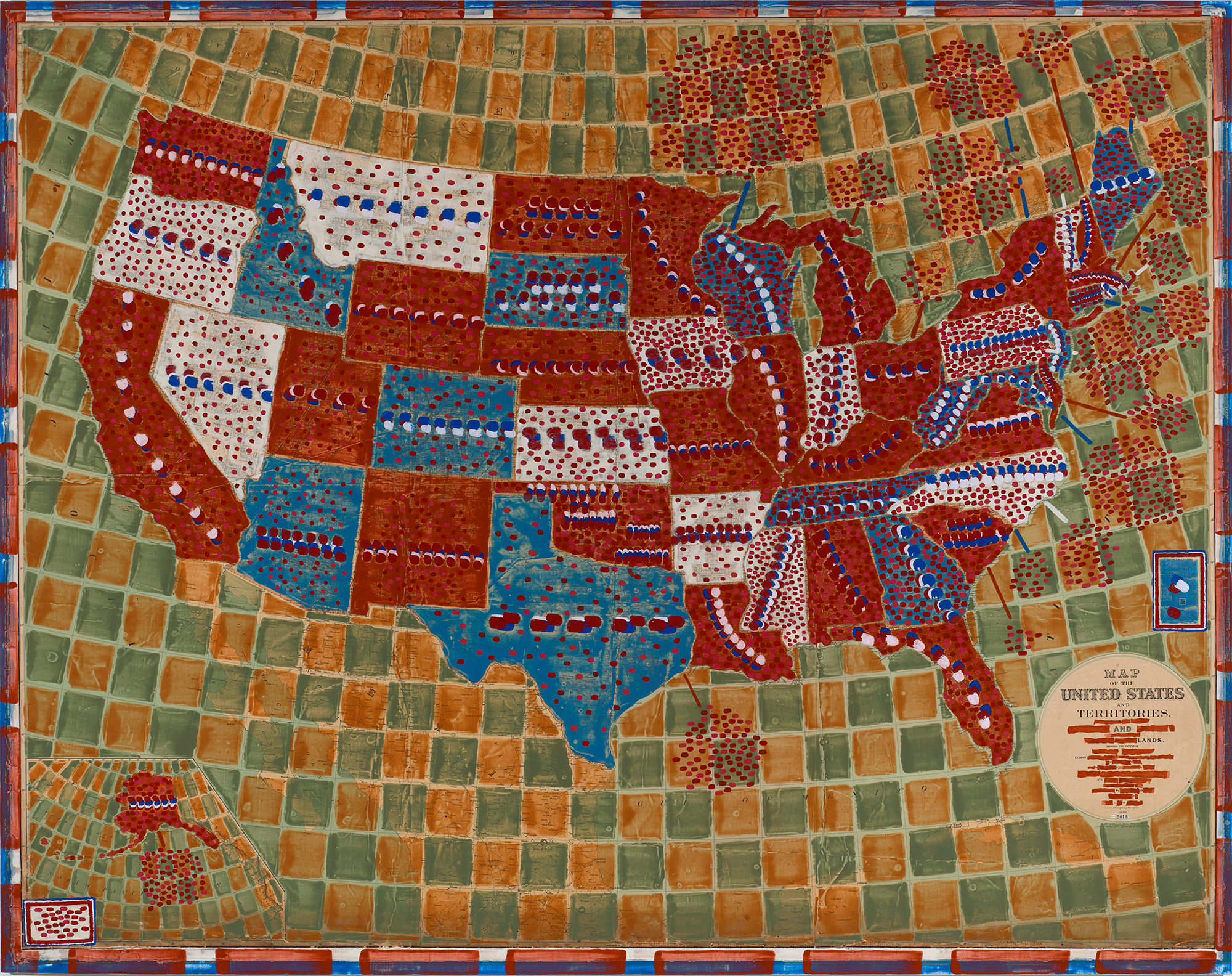
“What’s in a Name? (state names + the number of major geographic features named after indigenous people & words marked with red)” that Mills finished in 2018 is an acrylic-painted and collaged 65-by-83-inch map that was printed in 1890 – that critical year when the official colonization of Native American lands seemed to be complete. In the work, Mills redacts the name of the state (or territory) with daubs of paint and puts a mark in each state for every official element therein (municipalities, etc.) that has an indigenous name. To most of us now, Oklahoma’s many name dots are a mystery, since between 1890 and when it achieved statehood in 1907, the unorganized “Indian Territory” became incorporated as part of the “Oklahoma Territory.” The date of the map, in other words, sets the stage for Mills’ illustrated story. How to do this? Mills had to go through every state’s municipalities and features and do the count himself. From there, the questions cascade: How many states have native names? More than half. Which has the most? Wisconsin, with about 380. Maine has about half that number.
—Daniel Kany “Art review: Mapping data makes for informative art at CMCA” review, Maine Sunday Telegram, July 7, 2019