NEW YORK
(About New York Excavations)
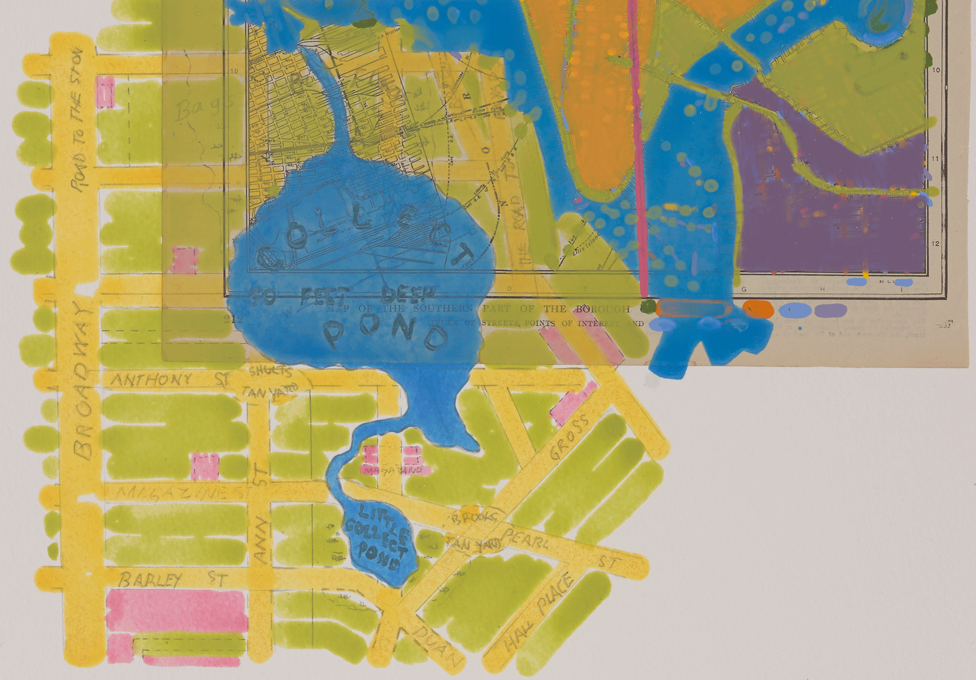
"The insert in Dan Mills’ maps 'excavates' and important geographic feature formerly covering several blocks of today’s Chinatown. Collect Pond, 60 feet deep and fed by an underground spring, was for two hundred years the main source of water for Manhattan residents. Before that, it’s shores were—respectively—home to a band of Lenape Native Americans, a popular recreational area for colonists, and a site of polluting slaughterhouses and tanneries. By the 1800s, to drain what had become an open sewer, engineers built a canal (part of which became Canal Street) yet for decades the area remained for decades a swampy, disease-infested slum. On the site today, Collect Pond Park features a formal reflecting pool perhaps wishing to be a spring-fed pond again."
—Katharine Harmon, "You Are Here NYC: Mapping the Soul of the City", Princeton Architectural Press, 2016
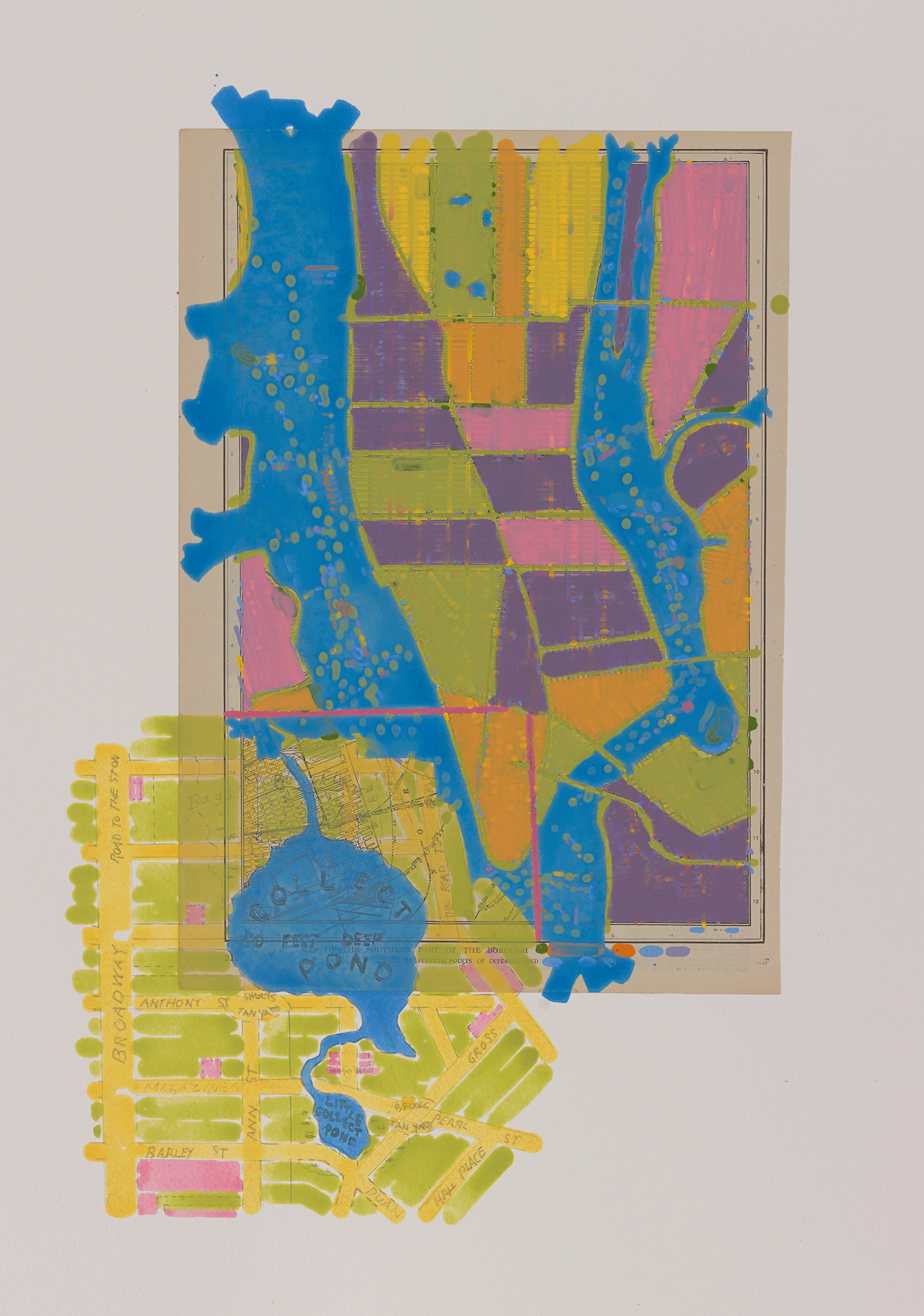
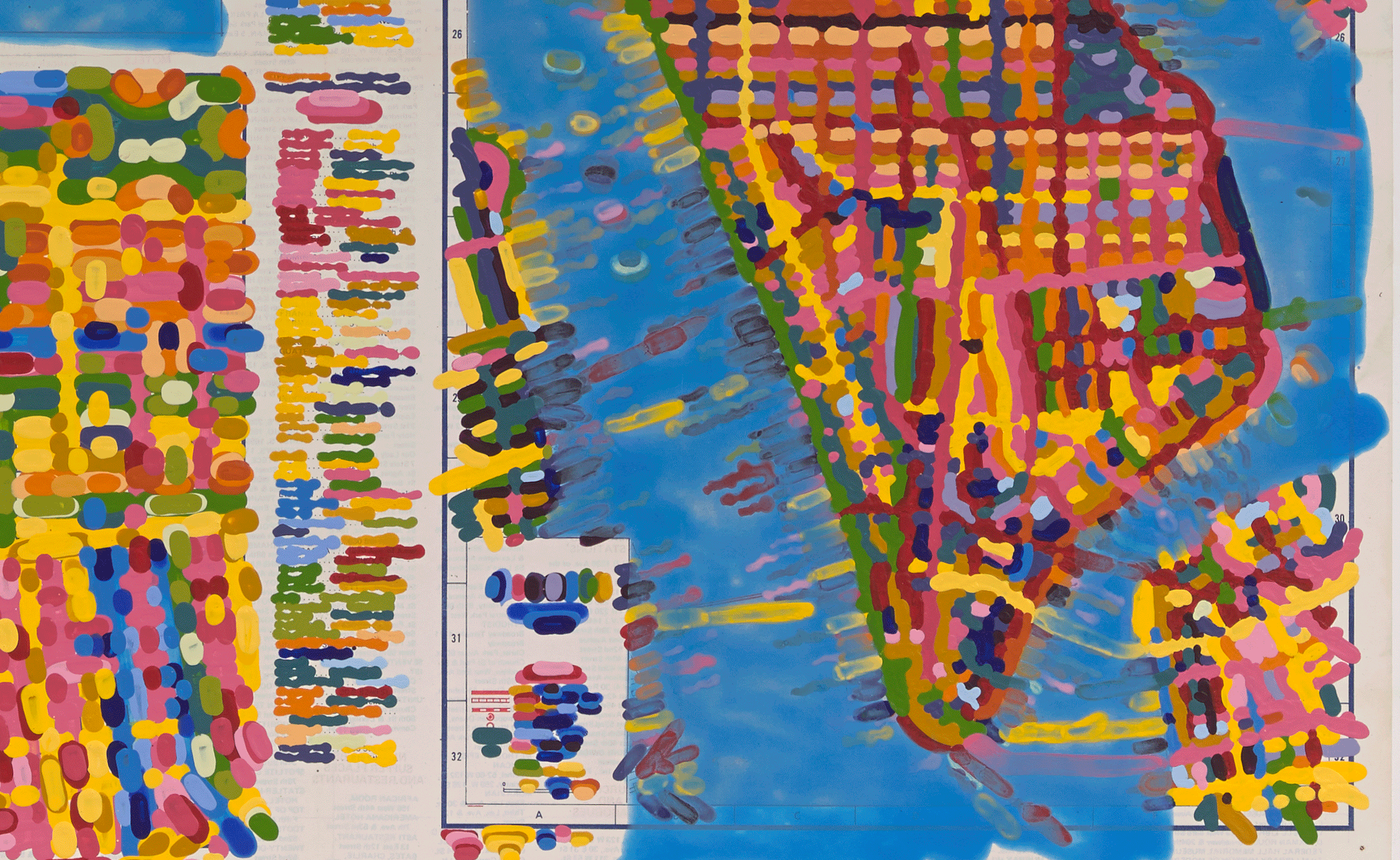
New York Excavation I, 2014, acrylic and graphite on printed map on paper, 30 x 22 1/2 inches
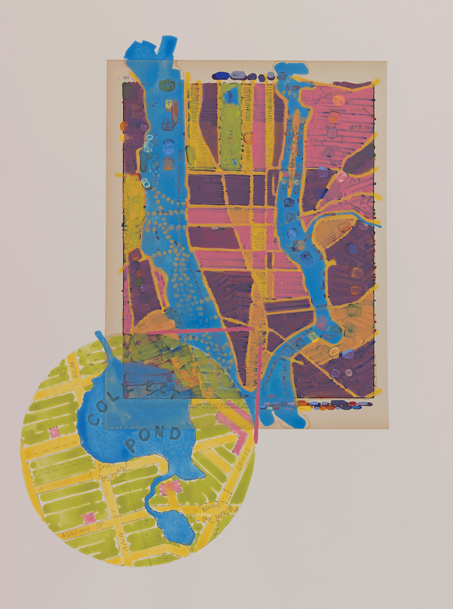

New York Excavation II, 2014, acrylic and graphite on printed map on paper, 30 x 22 1/2 inches
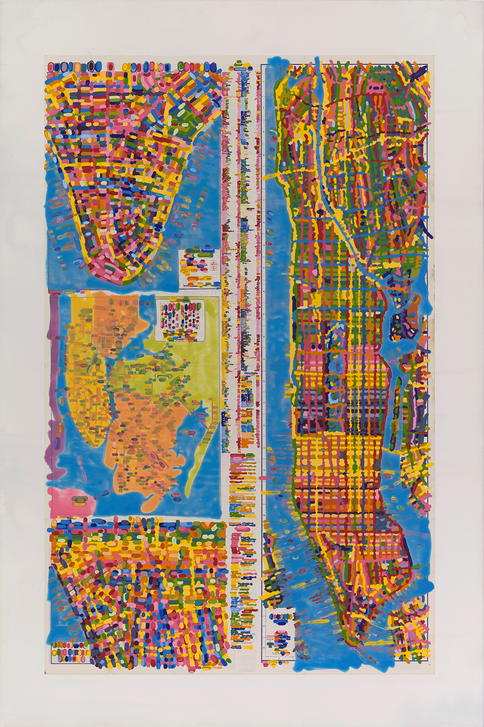
New York Portrait I, 2014, acrylic on printed map laid down on board, 42 x 28 inches. Collection of the Ewing Gallery of Art + Architecture, University of Tennessee, Knoxville.
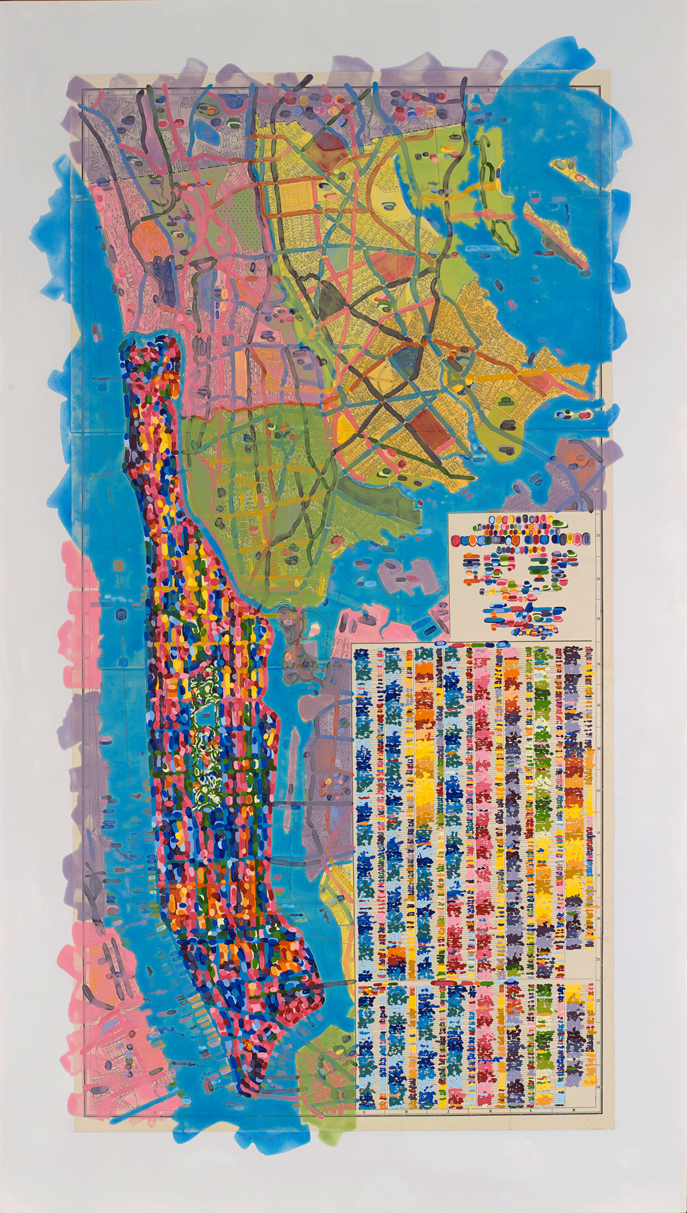

New York Portrait II, 2014, acrylic on printed map laid down on board, 49 x 28 inches